NOAA-NASA MD campaign

NASA and NOAA pioneered a shipborne photometer campaign across the Atlantic

In 2023, NASA and NOAA launched a groundbreaking Atlantic campaign, placing an automated, AERONET-compatible sun photometer aboard a research vessel for the first time. The goal was simple but ambitious: collect high-quality aerosol optical depth (AOD) data over ocean regions, long neglected by traditional land-based monitoring networks. By measuring directly from the sea, scientists could fill a critical observational gap and strengthen satellite validation where fixed stations are sparse.

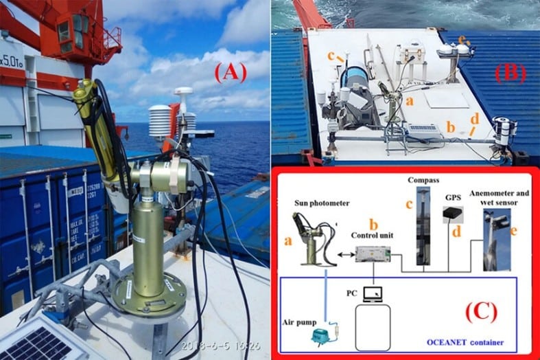
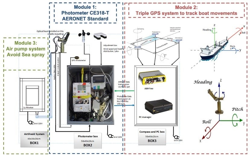
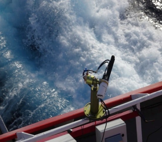
The instrument, a CIMEL CE318‑T, was specially adapted for shipborne deployment. Engineers stabilized it against vessel motion, added protective enclosures to withstand sea spray, and updated the firmware to maintain accurate sun-tracking and sky radiance measurements. Calibrations were aligned with AERONET protocols, ensuring the data matched the rigorous standards of land-based sites.

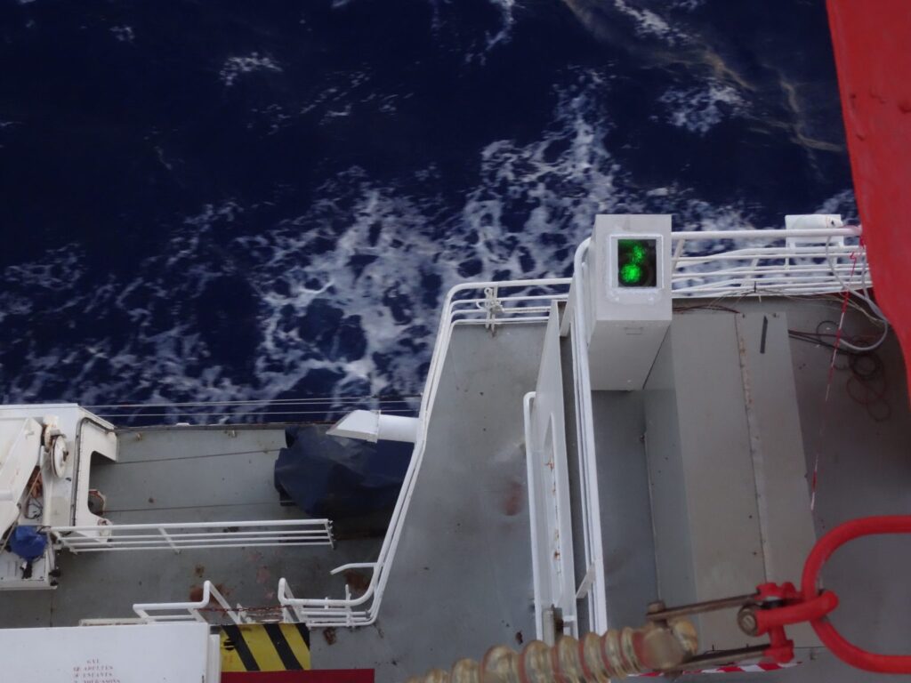
Adapted CIMEL CE 318‑T photometer installed on the vessel, stabilized against motion and protected from spray

Voyage across the Atlantic

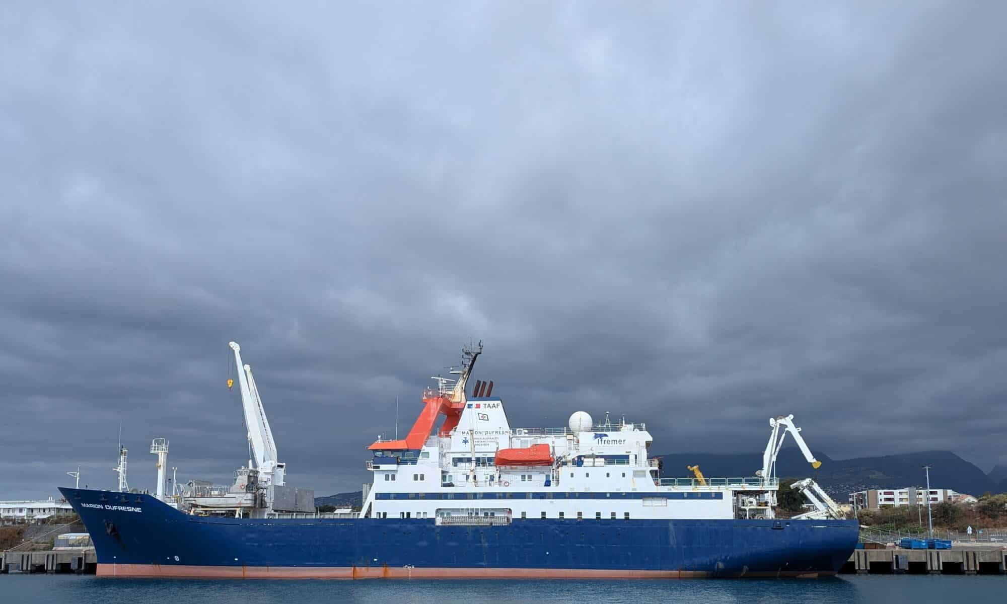
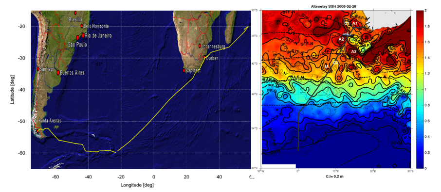
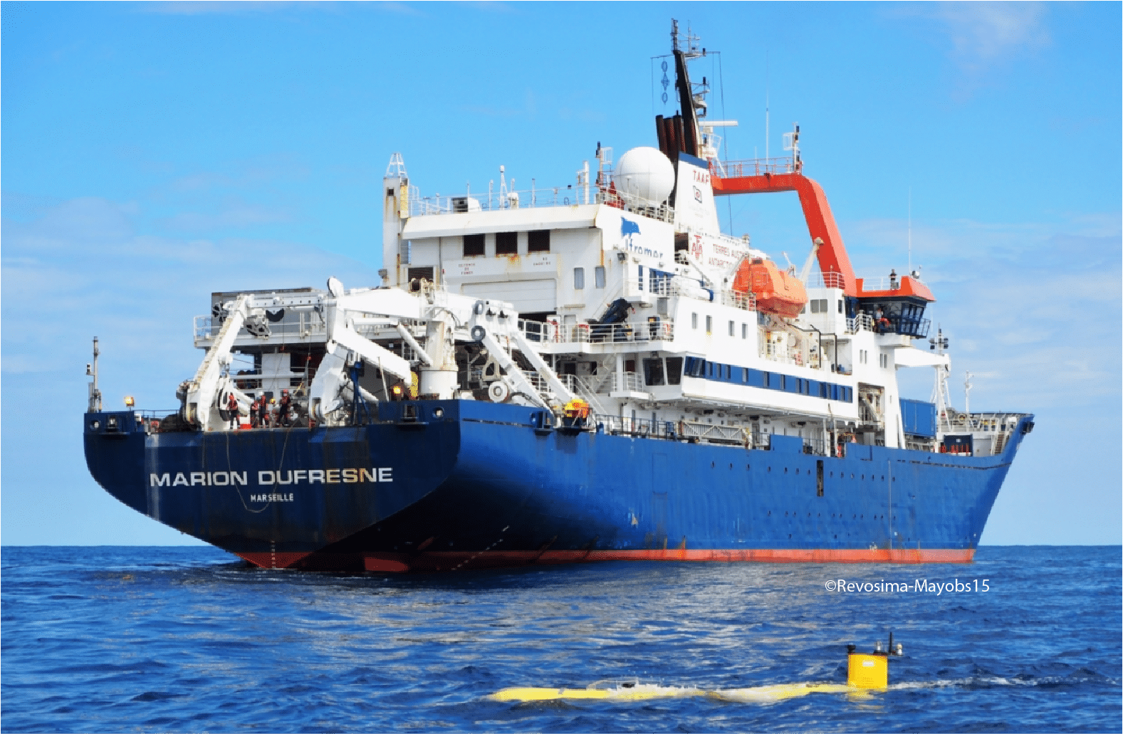
Aboard the RV Marion Dufresne, the photometer captured aerosol characteristics along a route stretching from the tropical Atlantic, across the Intertropical Convergence Zone (ITCZ), and into the mid-latitudes. The ship crossed the ITCZ three times, recording interactions between Saharan dust, marine aerosols, and cloud systems. Over the three-year period, the dataset revealed patterns of episodic dust transport, background sea-spray, and long-range aerosol variability.

The campaign was conducted in close collaboration with the LOA through the AGORA-Lab, which ensured data quality control, calibration traceability, and scientific analysis in coordination with NASA’s AERONET team.

RV Marion Dufresne cruise track across the Atlantic, showing key aerosol sampling regions.

Key insights include:

  • Shipborne AOD retrievals were on par with established AERONET sites, confirming data quality.
  • The measurements provide essential reference points for satellite sensors like PACE and support improved aerosol transport modeling.

Bridging the gap in ocean observations

Oceanic aerosol measurements are scarce but essential for accurate climate modeling and satellite validation. By deploying high-precision, automated photometers on ships, NASA and NOAA created a bridge between sparse ground stations and satellite footprints. This approach allows for continuous monitoring, capturing both episodic events like dust storms and consistent background conditions.

The campaign also sets a template for future maritime aerosol monitoring. Plans include deploying similar instruments on additional vessels, extending geographic coverage, and integrating vertical profiling systems or unmanned aerial platforms. Data are archived in standardized formats and made publicly available, ensuring the scientific community can leverage the measurements for satellite match-ups, climate model validation, and process studies.

By venturing directly into the Atlantic, NASA and NOAA have opened a new chapter in aerosol observation. This initiative not only fills a critical gap in global monitoring but also enhances our understanding of aerosol-cloud-climate interactions in remote ocean regions.

References

  1. Torres, B. et al. 2025. Adaptation of the CIMEL‑318T to shipborne use: 3 years of automated AERONET-compatible aerosol measurements on board the research vessel Marion Dufresne. Atmos. Meas. Tech., 18, 4809‑4838. DOI:10.5194/amt‑18‑4809‑2025.
  2. Torres, B. 2024. Three years of aerosol measurements using an automated photometer on the first long-term AERONET ship site. LOA/Apolo Univ. Lille.
  3. AERONET / Maritime Aerosol Network (MAN) website.
  4. PACE Technical Report Series Vol 11. 2023. PACE Science Data Product Validation Plan. NASA.

TRANSAMA campaign

TRANSAMA Campaign: Exploring aerosols across the oceans

In April–May 2023, the French research vessel Marion Dufresne II set sail from La Réunion Island toward Barbados on a unique mission: the TRANSAMA campaign (Transit to AMARYLLIS-AMAGAS). As part of the MAP-IO program (Marion Dufresne Atmospheric Program–Indian Ocean), this expedition aimed to deepen our understanding of aerosols — tiny particles suspended in the atmosphere – and their behavior over the open ocean.

Aerosols, whether transported from distant continents or generated locally, play a critical role in cloud formation, sunlight reflection, and climate dynamics. Yet, their behavior over the oceans remains poorly documented due to the logistical challenges of conducting continuous measurements at sea. TRANSAMA was designed to fill this gap by deploying state-of-the-art instrumentation capable of capturing both column-integrated and vertically resolved aerosol data in a fully autonomous, shipborne environment.

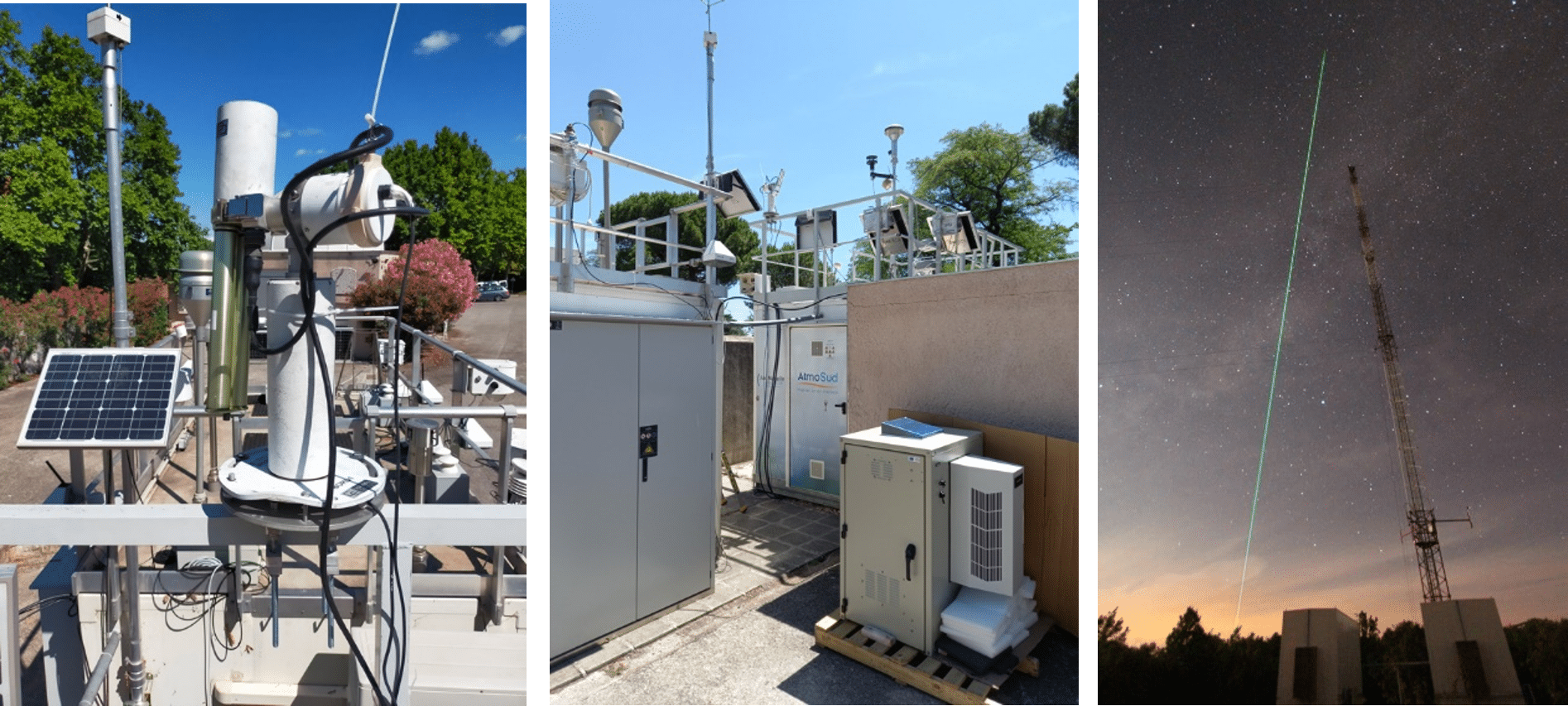
To meet this challenge, CIMEL collaborated closely with the Laboratoire d’Optique Atmosphérique (LOA) through their joint research structure, AGORA-Lab, which coordinated and supported all the instrumental installations aboard the ship.

Two CIMEL instruments formed the backbone of this observational campaign. The CE318-T Sun/Sky-Lunar photometer, set up permanently on board the ship since 2021, continuously recorded aerosol optical depth and particle size distribution during daylight hours, while the micro-LiDAR scanned the vertical structure of the atmosphere, revealing the layering of aerosols and their interactions with clouds.

Installed on the deck and carefully adapted for marine conditions, these instruments worked in harmony, providing a detailed picture of the atmosphere above the Atlantic.

Spatio-temporal variability of aerosol properties during the TRANSAMA campaign (21 April–15 May 2023) aboard the RV Marion Dufresne II. Measurements were conducted along the route from La Réunion Island to Barbados. (a) 3D variation of NRB at 532 nm from lidar measurements overlaid on a true-color image of the covered regions. (b) AOD at 440 nm and (c) EAE at 440/870 nm derived from photometer observations, displayed on topographic maps. Photometer data include L1 and L1.5 solar and lunar observations. Red345 pins mark the ports at Le Port (La Réunion), Recife (Brazil), and Bridgetown (Barbados).

Each observation contributed to a growing dataset that bridges the gap between local measurements and global atmospheric models.

Following the success of the 2023 campaign, the set up of a new CE376 lidar aboard Marion Dufresne in the framework of the OBS4CLIM project is scheduled for late October 2025. Once the lidar will be set up on board the vessel, it will record regular mobile measurements during the ship’s rotations from La Réunion island to the French Southern and Antarctic Lands (TAAF). These next voyages will further extend the temporal coverage of aerosol observations and help scientists understand the seasonal variations and long-range transport processes over the Indian and Atlantic Oceans.

Key publications

NASA-ARSET

NASA-ARSET reveals how AERONET contributes to air quality and climate applications

Ground-based networks such as AERONET play a crucial role in atmospheric science and air quality monitoring. During its latest NASA ARSET training titled “Atmospheric Composition Ground Networks Supporting Air Quality,” AERONET was showcased as a global benchmark in providing high-quality aerosol optical data for researchers, air quality managers, and decision-makers.

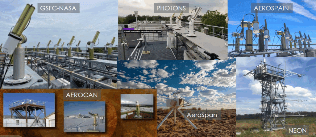
CIMEL CE318-T photometer enables fully autonomous, standardized, and long-term aerosol monitoring across diverse environments—from megacities to deserts and polar regions. With over 600 stations in 80+ countries, AERONET has become a global reference in satellite validation and atmospheric composition studies.

The ARSET training session reveals:

  • How ground-based observations complement satellite missions
  • The role of AERONET in policy-relevant applications
  • The importance of consistent, open-access data

You can access the training here: NASA ARSET Program

Key benefits of joining NASA-AERONET:

  1. Global data integration: As part of AERONET, CE318-T data integrates into a global network, allowing users to compare and access high-quality, standardized aerosol data worldwide, enhancing research with broader data context.
  2. Real-time data accessibility: AERONET provides near real-time data processing and availability on its online platform, allowing end-users to access and analyze current aerosol measurements efficiently.
  3. High-quality data: CE318-T photometers within AERONET are regularly calibrated at NASA’s calibration facilities, ensuring consistent, reliable, and high-quality data that meet strict scientific standards.
  4. Comprehensive aerosol data products: AERONET processes raw CE318-T measurements to deliver aerosol properties like aerosol optical depth (AOD), particle size distribution, and water vapor content, providing users with valuable insights without needing to process the raw data manually.
  5. Research collaboration opportunities: By participating in AERONET, end-users gain access to a collaborative network of scientists and research institutions globally, fostering opportunities for joint research projects and data sharing.
  6. Data validation for satellite missions: AERONET data is widely used to validate satellite aerosol measurements, allowing end-users to contribute to and benefit from satellite-derived aerosol research and applications in atmospheric studies.
  7. Recognition and credibility: Being part of AERONET enhances the credibility of the data collected, as the network is globally recognized in atmospheric sciences, potentially increasing the impact and visibility of users’ research.
Network of Networks – Calibration Centers/Sites
AERONET network – Calibration Centers/Sites

CIMEL CE376 Lidar at the Cyprus Institute

CIMEL CE376 Lidar Strengthens Aerosol and Dust Monitoring at the Cyprus Institute

TThe Cyprus Institute’s Climate and Atmosphere Research Center (CARE-C) continues to enhance its atmospheric observation capabilities with the CIMEL CE376, a compact, automatic aerosol lidar system providing high-resolution vertical profiles of aerosols and dust over the Eastern Mediterranean.

Installed on the institute’s rooftop platform, the CE376 has been operating continuously since late 2021, supporting advanced research and real-time environmental monitoring as part of the EMME-CARE project.

Advanced Technical Features:

  • Dual-wavelength operation at 532 nm and 808 nm.
  • Polarization channel at 532 nm for depolarization ratio retrievals.
  • Vertical range: Up to 10 km in daytime and 18 km at night.
  • Vertical resolution: 15 m; Temporal resolution: 1 s.

This system is designed to be compact and energy-efficient, suitable for continuous, remote, and even mobile operations — ideal for climate-sensitive regions like the Eastern Mediterranean and the Middle East.

Accurate Dust and Aerosol Profiling

The CE376 provides real-time vertical profiles of:

  • Particle backscatter and extinction coefficients
  • Volume depolarization ratios for aerosol typing
  • Planetary boundary layer (PBL) height estimation

Recent observations show the lidar’s capacity to clearly distinguish between clean atmospheric layers and dust intrusions originating from North Africa. Notably, during spring 2024, several Saharan dust events were recorded over Cyprus, with elevated layers reaching above 5 km and enhanced depolarization ratios indicating non-spherical particles consistent with mineral dust.

Calibration and Data Quality

An internal calibration and data correction procedure has been implemented to ensure the high accuracy of depolarization ratio measurements. Molecular depolarization values are now well-aligned with theoretical expectations (~0.0033), allowing for robust identification and classification of aerosol types.

The processed and corrected data are openly available via the Cyprus Institute’s EMME-CARE Upper-Air Data Portal, providing the scientific community and policymakers with vital insights into aerosol dynamics, air quality, and climate interactions across the region.

The site also hosts a CIMEL CE318-T photometer as part of the AERONET network, enabling valuable synergy with the CE376 for improved aerosol classification and dust monitoring.

Explore real-time data here: https://emme-care.cyi.ac.cy/data/upper-air-over-cyprus/

New CE710 Raman LiDAR

Pioneering Aerosol Remote Sensing: LOA and CIMEL’s Journey with the CE710 LiDAR for ACTRIS

Keywords: LiDAR, Aerosols, monitoring, remote sensing, ACTRIS, Raman.

The Laboratoire d’Optique Atmosphérique (LOA) at the University of Lille, in collaboration with CIMEL, focuses on studying clouds, aerosols, gases, and their interactions with radiation, utilizing advanced remote sensing instrumentation for experiments, observations, and modeling. LOA brings its expertise to ACTRIS as the Quality Assurance and Control Lead, playing a crucial role in maintaining precise and reliable photometric aerosol measurements.

Since 1991, LOA and CIMEL have collaborated to advance and refine photometry techniques for measuring aerosols and water vapor. This collaboration was at the origin of the NASA AERONET planetary network, built with the CIMEL sun/sky/lunar photometers for over three decades. In 2005, building on this success, they extended their cooperation to include aerosol LiDAR technologies. Finally, in 2020, LOA and CIMEL established a joint research laboratory, AGORA-Lab, to develop advanced remote sensing technologies, including Lidars and photometers, and to combine them for cutting-edge performance.

LiDARs provide high-resolution vertical profiles of aerosols and clouds, while photometers offer column-integrated aerosol optical properties. By combining these measurements, calibration, quality control and retrievals are enhanced, leading to better quantification and characterization of aerosols and higher-level data products.

Since 2012, CIMEL and LOA have collaborated on developing the CE710 LiDAR, a high-power, multi-spectral Mie-Raman-Fluorescence LiDAR, spearheading significant advancements in aerosol measurement capabilities. The first version, called LILAS, was set up on the ATOLL platform (Atmospheric Observatory of Lille) and has been part of ACTRIS since 2015.

LOA and CIMEL continuously advance the industrialization and validation of the CE710 LiDAR range, making it a cost-efficient, modular solution that is ACTRIS-ready, meaning it meets all current and future guidelines. This cutting-edge technology provides innovative features that enhance measurement accuracy, operational efficiency, and adaptability to evolving scientific needs.

  • Multi-wavelength emission: 355, 532 and 1064 nm.
  • Up to 15 detection channels: to profile a wide range of atmospheric parameters, including aerosol backscatter, depolarization, fluorescence, water vapor, trace gases, and temperature.
  • Advanced laser technology: Uses diode or flash-lamp pumped Nd:YAG lasers with energy per pulse up to 200 mJ at 355 nm and repetition rate up to 200 Hz.
  • Depolarization capability: Measures linear depolarization ratios at multiple wavelengths to distinguish between spherical and non-spherical particles.
  • Fluorescence detection: Provides additional vertically resolved information to improve aerosol typing.
  • Customizable configurations: The modular design allows adaptation to initial and evolving research objectives.
  • Robust and transportable design: Facilitates installation, inside or outside with optional thermal enclosure.
  • Data Processing: Includes AUSTRAL software for real-time visualization and interpretation of measurement data.
  • Enhanced data quality: The CE710 meets all the requirements of the stringent ACTRIS Quality Assurance guidelines, that ensure high measurement precision and reliability and are a prerequisite for data certification by ACTRIS.
  • Comprehensive aerosol profiling: The multi-channel design allows detailed characterization of aerosol physical and chemical properties, providing valuable inputs for atmospheric models.
  • Integrated calibration tools: The built-in remote control and calibration functions enable operators to consistently perform standardized quality control operations over time.
  • Advanced analysis capabilities: The AUSTRAL software offers real-time data processing and visualization, enabling quick assessment of atmospheric conditions and facilitating advanced research and collaborative projects.
  • Future-Proof Design: The modular architecture supports future upgrades, allowing the system to adapt to evolving scientific requirements and technological advancements.

BECOOL Project

becool balloon

Stratéole-2 Becool: micro-LiDARs span the globe aboard hot-air balloons up to 22km high in the stratosphere.

Keywords: Aerosols, LiDARs, monitoring, Earth observation, remote sensing, stratosphere, troposphere.

October 16th 2023

On the night of Wednesday, August 22, 2018, the CIMEL’s micro-LiDAR flew for the first time in a stratospheric balloon for the validation of the project, from Timmins Air Force Base, in Ontario (Canada).

Stratéole-2 is a program of observation of the dynamics of the atmosphere in the intertropical zone developed in partnership between CNRS and CNES. The LATMOS (Atmosphere, environment and space observations laboratory) through its joint laboratory with CIMEL: CIEL), the LMD (Dynamic Meteorology Laboratory), and the CSA (Canadian Spatial Agency) are also collaborating on this project. 

This Stratéole-2 project called BECOOL (BalloonbornE Cirrus and convective overshOOt Lidar) mainly consists in placing CIMEL’s micro-LiDARs in stratospheric hot-air balloons and flying them around the world. The onboard aerosols micro-LiDARs emit lasers downwards, contrary to the initial use (the shots are normally done from the ground towards the atmosphere).

The project Stratéole-2 represents several challenges as CIMEL had to develop, in collaboration with the LATMOS a micro-LiDAR prototype that must correspond to the following standards:

  • Weighting less than 7 kg
  • Consuming less than 10 W
  • Resisting harsh temperature conditions

Indeed, CIMEL’s LiDARs are well known for their robustness and energetic Self-reliance which allows low maintenance: practical when the LiDARs are up to 20km in the stratosphere!

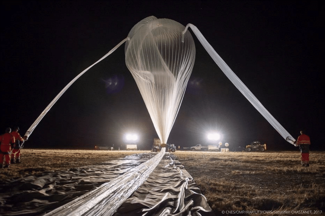
Figure 1: Preparation of a stratospheric balloon before the takeoff

The program uses stratospheric pressurized balloons filled with helium 11 to 13 meters in diameter. During 3 to 4 months, they are carried by the winds all around the tropical belt and are propelled up to 20 kilometers in the atmosphere. Some can travel across 80,000 kilometers around the world (Figure 2).

Figure 2: Stratéole-2 Long-duration balloon flights across the tropics to study atmospheric dynamics and composition / https://webstr2.ipsl.polytechnique.fr/#/

The project includes a total of three measurement campaigns realized between 2018 and 2025. Contrary to the previous one which served as a validation (and in which 2 micro-LiDARs were released), the second campaign was for scientific purposes. It started in mid-October 2021 and ended in April 2022, 3 micro-LiDAR balloons were released into the atmosphere from the Seychelles (Mahé). They collected valuable information which will then be analyzed for the study of atmospheric phenomena and their role in the climate. The third campaign is planned for 2025, with a further 4 micro-LiDAR balloons that will be released.

The objectives are to try to clarify some of the grey areas that hinder our detailed understanding of the atmosphere and its role in the Earth’s climate. BECOOL allows scientists to study atmospheric dynamics and composition such as convection or the dynamic coupling between the troposphere and the stratosphere. Exchanges and air movements between these two atmospheric layers are important and influence the whole planet.

However, the tropical region is difficult to access. Consequently, the classical methods of observation (by satellites, by plane, …) are not enough. This is why using balloons is strategic: they are the only ones able to observe these phenomena in real time and very closely to the atmosphere.

“It is a completely original mode of sampling, which is not obtained otherwise and allows results of unequaled finesse” (A. Hertzog).

Below is a quicklook from a Stratéole-2 micro-LiDAR taken from a balloon.

Figure 3: Quicklook LATMOS-Stratéole 2018

Bibliography:

E. J. Jensen et al, Bull. AMS, 129-143 (2017), M. McGill et al., Appl. Opt., (41) 3725-3734 (2002), J. S. Haase et al., Geophys. Res.L., 39, (2012), P. Zhu et al., Geos. Inst. Meth. and Data Systems, 89-98, (2015) J.-E. Kim et al, Geophys. Res. L. (43), 5895-5901 (2016), S. Davis et al., J.Geophys Res, 115 (2010) S. Solomon et al., Science (327), 1219-1223 (2010) V. Mariage et al., Optics Express 25 (4), A73-A84 (2017) ,G. Di Donfrancesco et al., Appl. Opt. (45) 5701-5708 (2006)  https://doi.org/10.1051/epjconf/202023707003

François Ravetta, Vincent Mariage, Emmanuel Brousse, Eric d’Almeida, Frédéric Ferreira, et al. BeCOOL: A Balloon-Borne Microlidar System Designed for Cirrus and Convective Overshoot Monitoring. EPJ Web of Conferences, EDP Sciences, 2020, The 29th International Laser Radar Conference (ILRC 29), 237, 07003 (2p.). ff10.1051/epjconf/202023707003ff. ffinsu-02896973f

https://www.ecmwf.int/sites/default/files/elibrary/2016/16866-strateole-2-long-duration-stratospheric-balloons-providing-wind-information.pdf

https://presse.cnes.fr/sites/default/files/drupal/202110/default/cp099-2021_-_strateole-2.pdf

https://videotheque.cnes.fr/index.php?urlaction=doc&id_doc=37302&rang=1&id_panier=#

Presidential mission in China

Mission présidentielle Chine-Macron

CIMEL in the French delegation of the French President on his mission in China.

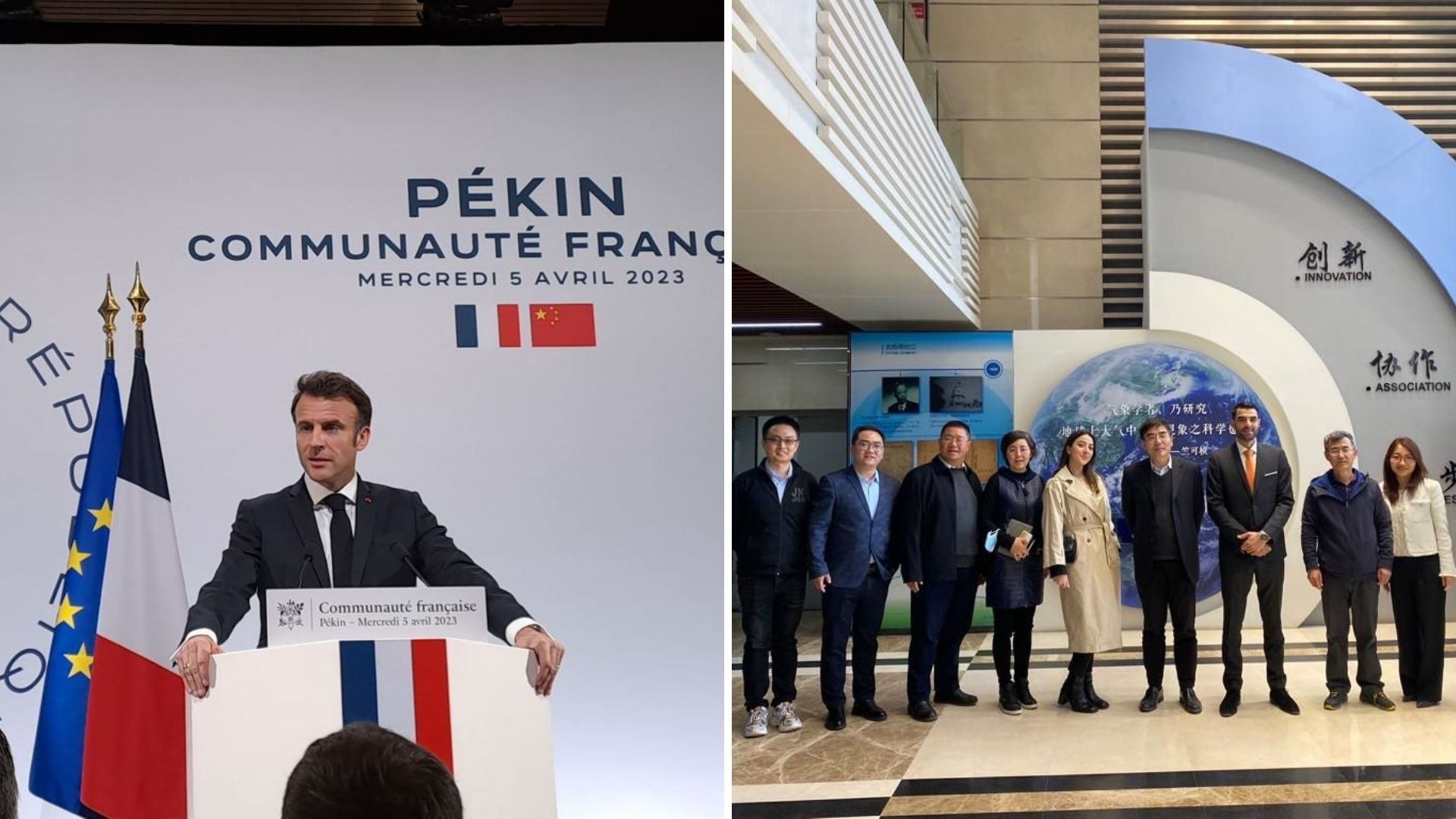
CIMEL is proud to have accompanied the French President Emmanuel Macron on his mission in China, organized in collaboration with Business France and the French Embassy from April 3rd to 7th 2023.

This was an important geopolitical event, as we were part of the first French delegation to come back in China after the reopening of the borders and the lifting of sanitary restrictions linked to COVID-19.

It was also an opportunity for companies such as ours (with special regards to Chromatotec, ENVEA Group, Greentech Innovation) to shine through lobbying and gathering decision makers on climate change and environmental issues.

Our Sales and Marketing Director, Idris SANHAJ and our International Business Developer Laura MARIT have represented CIMEL through business meetings with our Chinese partners (CMA Chinese Meteorological Agency, CAS Chinese Academy of Sciences, Environmental Monitoring Centers of Shanghai Municipality and Jiangsu Province, Guangzhou University…) and to exchange ideas with various members of the French delegation organized by Business France.

They had the opportunity to encounter the French President Emmanuel Macron and had a brief meeting with the Minister of Economy and Finance Bruno Lemaire to discuss the future of air quality application with our innovative solutions, in particular for the JO2024 Olympic Games in Paris.

During this mission, CIMEL has presented its remote sensing solutions for aerosols monitoring, used to increase the understanding of atmospheric phenomenas, improve and validate air quality models.

This combination of climate modeling, through in-situ sensors, satellite data, and ground remote sensing, allows for more accurate air quality forecasting and decision-making for public health and environmental management.

We look forward to continuing to serve our customers in China and across the globe with the same level of excellence and dedication that has become synonymous with our brand Made in France.

🙏 We extend our gratitude to Business France (Laurent Saint-Martin, Xavier CHATTE-RUOLS, Baptiste DELBENDE, Nicolas SESTIER), teamfranceexport (Valérie Alvarado-Zongo, Yang Yang, Michelle Portugal, Lian Qu), and CCI FRANCE CHINE (Caroline Penard, Christophe Lauras) for coordinating this successful business trip.

AAMS Cyprus Institute

The Climate and Atmosphere Research Center (CARE-C) of The Cyprus Institute using AAMS solution for atmospheric observation.

Keywords : Aerosols, Monitoring, Earth observation, Remote sensing, Wavelength, LiDAR, Photometer, AAMS, CARE-C.

The Cyprus Institute is non-profit research and educational institution with a strong scientific and technological orientation.

The Institute is divided into four research centers:

  • Energy, Environment and Water Research Center (EEWRC)
  • Science and Technology in Archeology and Culture Research Center (STARC)
  • Computation-based Science and Technology Research Center (caSToRC)
  • Climate & Atmosphere Research Center (CARE-C)

The Climate and Atmosphere Research Center (CARE-C) was founded at the Cyprus Institute in January 2020. It is a regional European Center of Excellence for Climate and Atmosphere Research, based in Cyprus, for the Eastern Mediterranean and Middle East (EMME) region. The aim of the center is to lead some researches about urgent climate change and air pollution challenges such as greenhouse gases, the water cycle, extreme weather, atmospheric dust and their impacts.

Therefore, the center owns a remote sensing group composed by a network of ground-based instruments located at three Cyprus Atmosphere Observatory (CAO) stations: Nicosia, Agia Marina Xyliatou and Troodos. Among these instruments, three CE318-T – Sun Sky Lunar Multispectral Photometers and a CE376 – Compact LiDAR.

CIMEL AAMS – Automatic Aerosol Monitoring Solution allows the study of the transportation of pollution, dust, smoke and all the aerosols related to atmospheric composition. For instance, optical characterization of dust and smoke particles are made thanks to the 2 wavelengths CE376 – Compact LiDAR. In addition, the instrument has depolarization capability, which is a relevant information for aerosols typing.

By using state-of-the-art solutions and collaborating with the Laboratoire d’Optique Atmosphérique (LOA – University of Lille/CNRS), the CAO provides high quality, long-term observations of key atmospheric pollutants relevant to air quality and climate change, and thus, brings value to the Cyprus Institute in different sectors such as Research, Innovation and Education. This collaboration is developing for many years in the frame of aerosol monitoring (AERONET), radiative flux monitoring and more recently with automatic Lidar/photometer synergy, in the frame of ACTRIS. Moreover, the cooperation between LOA and CAO, in the frame of AQABA campaign, allowed the first operation of the prototype shipborne version of CE318T.

Figure 1 : CE318-T – Sun Sky Lunar Multispectral photometer at Nicosia station.

Figure 2 : CE376 – Micro LiDAR at Nicosia station.
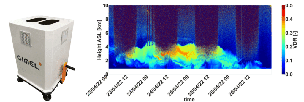
Figure 3 : Quicklook of the volume depolarization ratio during a dust event in Cyprus.

SORBETTO Winter School

SOlar Radiation Based Established Techniques for aTmospheric Observations (SORBETTO) Winter school.

Keywords : Aerosols, Monitoring, Earth observation, Remote sensing, Wavelength, LiDAR, Photometer, Radiation, Atmosphere, CAL/VAL, SORBETTO.

February 14th 2023

SOlar Radiation Based Established Techniques for aTmospheric Observations (SORBETTO) Winter school took place from February 6th to 10th at ESA-ESRIN (European Space Research Institute), in Frascati, Italy and was organized in collaboration with Sapienza University (Roma) and CNR-ISAC (National Research Council – Institute of Atmospheric Sciences and Climate).

SORBETTO is an important training event for young researchers collaborating within the international aerosol’s scientific community (gas and aerosol observations for climatological, meteorological, local and global air pollution studies, remote sensing and in-situ measurements, calibration of satellite measurements…).

Ground-based instruments deployed in Networks such as AERONET are key players to perform high quality observations that contribute to the Validation and Calibration (CAL/VAL) of satellite missions. Instruments such as Sun Sky Lunar Photometers or LiDARs allow to check that information derived from satellite sensors is comparable to ground measurements and thus, to validate their accuracy.


CIMEL Team operating an instrumental demonstration of CE318-T Sun Sky Lunar Photometer at University of Sapienza, 9th 2023.

The instrument show held on Thursday 9th at Sapienza University was the opportunity for students to attend a presentation of various solutions such as CIMEL CE318-T Sun Sky Lunar Photometer, exclusive instrument of NASA Aerosol Network AERONET.

It was a pleasure for CIMEL to attend the event with our great and exclusive Italian Business Partner XEarPro Srl. With 20 years of experience in the field of environmental monitoring, XEarpro Srl contributes in the development of applications and solutions to safeguard the environment around us. We collaborate closely to meet the needs of the Italian scientific community in term of aerosols remote sensing instruments. 

LiDAR LILAS

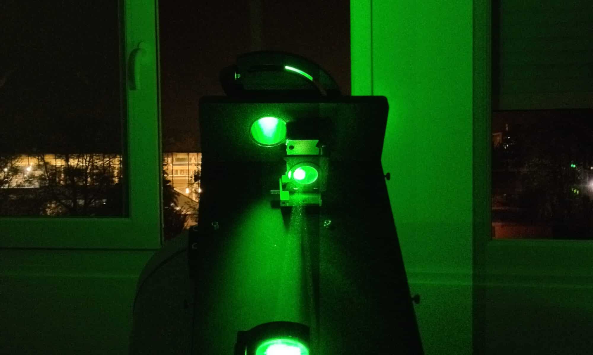
Multi-wavelength LILAS LiDAR Raman at the Laboratory of Atmospheric Optic (LOA).

Keywords : Aerosols, LiDARs, MicroLiDARs, monitoring, Earth observation, remote sensing, Raman, wavelengths, ash, dust, sand.

July 29th 2022

The Laboratoire d’optique atmosphérique (LOA) is a joint research unit of the National Center for Scientific Research (CNRS) of France and the University of Lille – Sciences and Technologies. The LOA studies the different components of the atmosphere, mainly clouds, aerosols and gas. In collaboration with the LOA, CIMEL created a joint research laboratory : AGORA-LAB.

Since 2005, the LOA has started the systematic observation of aerosols by LiDAR and has developed a database and an automated real-time data processing system. Its collaboration with CIMEL allowed the creation of the multi-wavelength LILAS LiDAR which was integrated into the European network EARLINET/ACTRIS in 2015.

The LILAS LiDAR was specifically designed and adjusted by CIMEL to meet a specific need of the LOA. The transportable multi-wavelength Raman research LiDAR LILAS offers a significant qualitative and quantitative value on aerosol parameters measured at night and during the day, in particular through its combination with CIMEL sun/sky/lunar photometers.

LILAS also allows the observation of clouds and the obtention water vapor and methane profiles. It also gives access to essential climate variables such as the absorption profile of atmospheric aerosols. Its maximum range can reach 20 km and allows it to study the lower stratosphere which can be useful in case of major volcanic eruption for example.

For the Data treatment, the AUSTRAL (AUtomated Server for the TReatment of Atmospheric Lidars) web server data is the processing tool, which provides real-time quicklooks of the LiDAR Range Corrected Signals (RCS) and Volume Depolarization Ratio (VDR) as well as Klett inversion results (extinction and backscatter coefficient profiles).

To answer the need of various stakeholders, the CE710 LiDAR is a fully customizable high power multi-channel aerosols LiDAR resulting from the collaboration between the LOA, CIMEL and Dr. Igor Veselovskii institute. Depending on the requirements and budgets of each, it exists multiple options to customize the LiDAR. For exemple, the choice of the laser type and the wavelengths, the depolarization options or the Raman options (and many more).

Thanks to its precision in the detection of aerosols, the LILAS CE710 LiDAR has highlighted many atmospheric natural events such as volcanic eruptions (ash) or dust and sand events for example but also biomass burning particles coming from fires. LILAS data and all the LiDAR’s activities between the LOA and CIMEL bring a precious monitoring tool to understand atmospheric phenomenas over France, Europe and worldwide.


Figure 1 : View of LILAS (telescope, laser, and acquisition bay) in vertical view, open roof hatch and example of observed aerosol profiles. LILAS is a transportable multi-wavelength Elastic & Raman LiDAR. It has 3 elastic channels (355, 532 and 1064 nm), 3 Raman channels (387, 407 and 530 nm) and 3 depolarized channels (355, 532 and 1064 nm).

Figure 2: Night time LILAS operation during SHADOW-2 campaign in Senegal (Credits: Q. Hu, LOA)

Figure 3 : Detection of smoke particles injected up to 17 km into the stratosphere by intense pyro-convection generated by the Canadian wildfires of summer 2017 (Hu et al., 2018).

Figure 4: Illustration of the extreme event in October 2017. LiDAR LILAS time series from 16/10/17-16:00 to 17/10/17-06:00 UTC at the Lille site (LOA). (a) The reddest regions indicate a high concentration of particles while the blue regions indicate a very low concentration of particles. (b) Aerosol depolarization which informs us about the shape of the particles and thus their nature, desert or fire particles.
 Graphic credits Q. Hu, LOA

Figure 5: LiDAR LILAS LOA
Communications and posters
  • Podvin T., P. Goloub, D. Tanré, I. Veselovskii, V. Bovchaliuk, M. Korensky, A. Mortier, S. Victori, .LILAS, un LIDAR multispectral et Raman pour l’étude des aérosols, de la vapeur d’eau et des nuages, Atelier Experimentation et Instrumentation 2014 (oral presentation)
  • Podvin T, Q. Hu, P. Goloub,  O. Dubovik, I. Veselovskii, V. Bovchaliuk, A. Lopatin, B. Torres, D. Tanré, C. Deroo, T. Lapyonok, F. Ducos, A. Diallo. , LILAS, le Lidar multi spectral Raman polarisé et quelques résultats d’inversions, Atelier Experimentation et Instrumentation 2017 (poster presentation).
  • Hu et al., Aerosol absorption measurements and retrievals in SHADOW2 campaign, ICAC 2017, International Conference on Aerosol Cycle, 21 – 23 Mar, Lille
  • Hu et al., A test of new approaches to retrieve aerosol properties from Photometer-LiDAR joint measurements, ESA/IDEAS Workshop 2017, Lille, 06-07 Apr 2017
  • Hu et al., Retrieval of aerosol properties with Sun/Sky-photometer and LiDAR measurements, ACTRIS-FR, Workshop, Autrans Méaudre en Vercors, 3-5 mai 2017
  • Hu et al., Retrieval of aerosol properties with Sun/Sky-photometer and LiDAR measurements, 28th ILRC, international LiDAR and Radar conference, Bucharest, 25 – 30 June
  • Hu et al., Lidar measurements with 3-depolarization in Lille, 3rd ACTRIS-2 WP2 Workshop, Delft, 13-17 Nov 2017.