ROSAS – CESBIO

CESBIO_ROSAS

ROSAS – A new BRDF photometer installed in Lamasquère by CESBIO

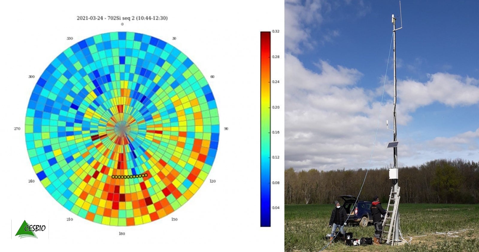
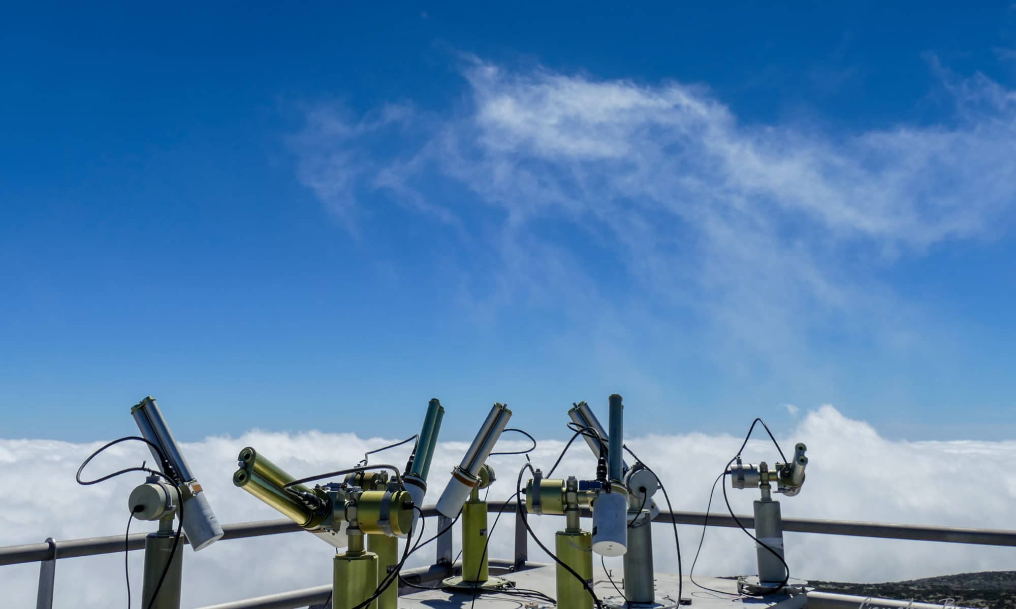
The Lamasquère site (France) is now equipped with a CIMEL 12 filters photometer (CE318-TU12) which measures direct and diffuse irradiation, and the directional reflectance of the surface (BRDF).

This system, installed in March 2021, is called RObotic Station for Atmosphere and Surface (ROSAS) and operates mounted on top of a 10 m high mast in a field on the agricultural area of Lamothe farm in Lamasquère (France). The CESBIO ROSAS station is thus the 3rd site of this type worldwide after the CNES station in La Crau (France) and the CNES/ESA station in Gobabeb (Namibia), and the first to characterize an agricultural vegetated surface, with seasonal and inter-annual variations of the cover.
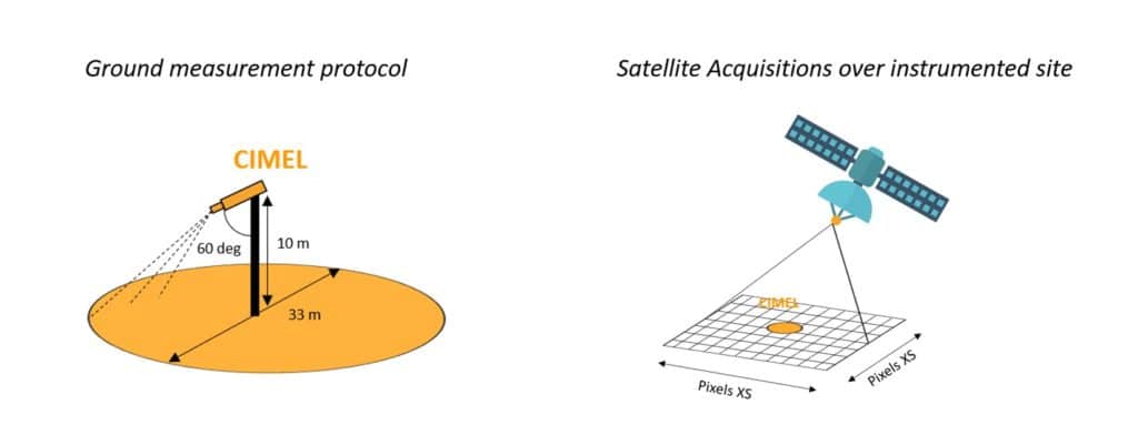
The spatial and temporal heterogeneity of the surface of this new site makes it more suitable for the validation of surface reflectance (after atmospheric correction), than for the absolute calibration of satellite sensors, as it is the case for La Crau and Gobabeb. When the Lamasquère field crops become very green and dense, the surfaces are dark and the atmospheric correction errors have a strong impact on the reflectance estimates, and when the crops are mature or the plot is bare ground, the adjacency effects due to the nearby forest become strong. Such in situ measurements are thus of primary interest to CESBIO, CNES and the broader scientific community.

The data are automatically transmitted to CESBIO and CNES every hour via the mobile phone network (GPRS), and processed periodically to derive the filtered bi-directional reflectance distribution function (BRDF).

Here below, you can find the first BRDF measurements acquired a few days after the validation of the station:
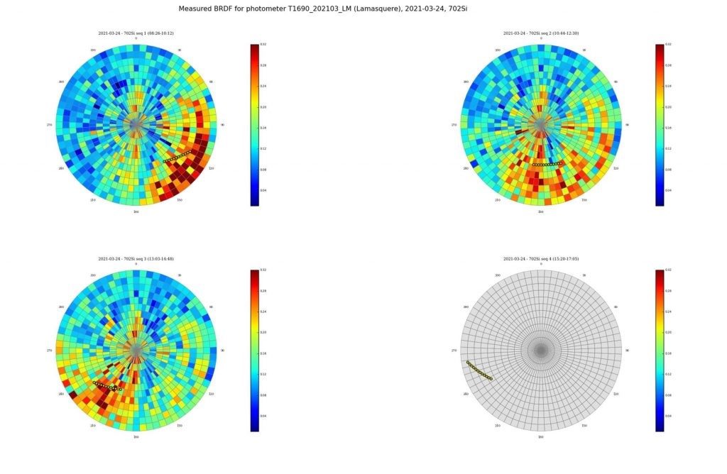
Polar diagrams of surface reflectances measured by the ROSAS station in Lamasquère. The 0° azimut corresponds to observations towards the South. The top left image was taken in the morning, the top right around noon, bottom left in the afternoon, and bottom right later on after the arrival of clouds. The yellow dots indicate the position of the sun . The radius of the graph corresponds to the zenith angle, and the other dimension is the azimuth with regard to the North.

Keywords: CIMEL, photometer, ROSAS, CNES, AERONET, CESBIO, BRDF

More information on : https://lnkd.in/dhh7KXN

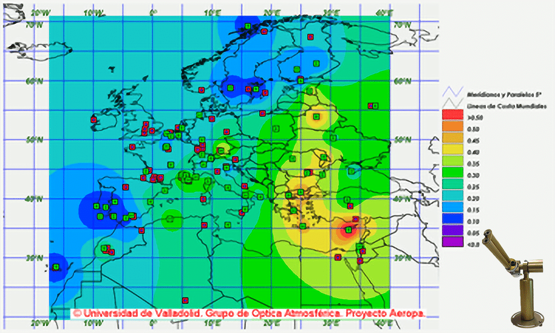
RIMA NASA-AERONET network : Long-term monitoring of aerosol properties

UVa - Proyecto Aeropa

RIMA NASA-AERONET network: Long-term monitoring of aerosol properties

RIMA (Red Ibérica de Medida fotométrica de Aerosoles) is a scientific network for the long-term monitoring of columnar aerosol properties based on sun-photometer measurements. RIMA is federated to AERONET (AErosol RObotic NETwork), a NASA program in collaboration with the University of Lille (LOA). According to the AERONET aims, the scientific objectives of RIMA involve the characterization of aerosols for climate studies, the validation of satellite products and the synergies with other measurements and data correlation.

RIMA follows all AERONET protocols (calibration, measurements, data policy, etc.) and its sites and data are available through the AERONET web site. The key task of calibration and the network management are carried out by the Group of Atmospheric Optics of the University of Valladolid (GOA-UVa) and master instruments are calibrated at the high-mountain facility CIAI (Izaña Atmospheric Research Center, AEMET) in collaboration with PHOTONS and CIAI-AEMET. Large support is obtained from the AERONET (NASA) and PHOTONS (University of Lille). The calibration facility used by CIMEL for photometers in Izaña is important thanks to its pure sky and its absolute zero which allows a perfect calibration of those solutions since 2006.

A software named Caelis was recently developed by GOA as a service to the RIMA community with the aim to facilitate the network management and the control of the site instruments and measurements. This tool relies on a powerful relational data base which represents a great potential for the scientific work as well.

Keywords: Aerosols, AERONET, Calibration, Sun/Sky/Lunar Multispectral Photometer, Earth observation, Atmospheric monitoring, Satellite CAL/VAL

Acronyms :

  • CIAI: Centro de Investigación Atmosférica de Izaña
  • GOA-Uva: Grupo de Optica Atmosférica – Universidad de Valladolid
  • LOA: Laboratoire d’Optique Atmosphérique

Citation : Toledano, C. & Cachorro, Victoria & Berjón, Alberto & Frutos Baraja, A. & Fuertes, David & González, R. & Torres, Benjamin & Rodrigo, R. & Bennouna, Yasmine & Martín, L. & Guirado-Fuentes, Carmen. (2011). RIMA-AERONET network: Long-term monitoring of aerosol properties. Optica Pura y Aplicada. 44. 629-633.

READ THE ARTICLE  HERE!

ESA – New remote sensing tech on satellite for atmospheric measurements

VEGA Rocket

ESA – New remote sensing tech on satellite for atmospheric measurements

3 SEPTEMBER 2020

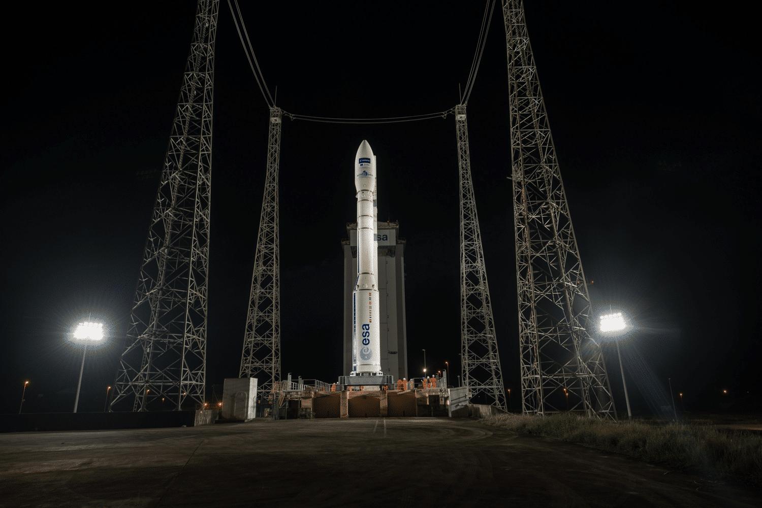
On September 3rd 2020, ESA has launched 42 small satellites aboard a Vega rocket from Kourou in French Guiana for the Copernicus Project.

This new type of satellites capable of measuring CO2 emissions to the nearest kilometer and pinpointing their origin.

One of these nanosatellites, PICASSO, carries remote sensing technology developed which will be used to undertake measurements in the upper layers of Earth’s atmosphere.

PICASSO stands for Pico-Satellite for Atmospheric and Space Science Observations and it’s the first CubeSat nanosatellite mission of the Royal Belgian Institute for Space Aeronomy.

Weighing only 3.5kg, it carries two measuring instruments for atmospheric research: A Visible Spectral Imager for Occultation and Nightglow (VISION) and a system to conduct plasma measurements in the ionosphere, the Sweeping Langmuir Probe (SLP).

This project of analysis and collection of satellite data will be carried out over 5 years. The aim is to obtain as much precise information as possible on the quantification of gases in the air.

We will be able to know exactly the real CO2 emission by country, cities and the origin of gases (if it’s anthropogenic or natural).

Thanks to this initiative, more and more surveillance systems will be sent into space over the next few years, which will help develop the market for remote sensing solutions.

Cimel will be part of this development by bringing additional data thanks to its photometers and LiDARs to help calibrate and validate data from satellites.

Credits: ESA-M. Pedoussaut

MOSAIC

MOSAiC expedition for climateThe world largest polar expedition

1 SEPTEMBER 2019 – 31 OCTOBER 2020

The MOSAiC (Multidisciplinary drifting Observatory for the Study of Arctic Climate) expedition is the largest polar expedition in history, involving hundreds of scientists from twenty countries for climate researches.

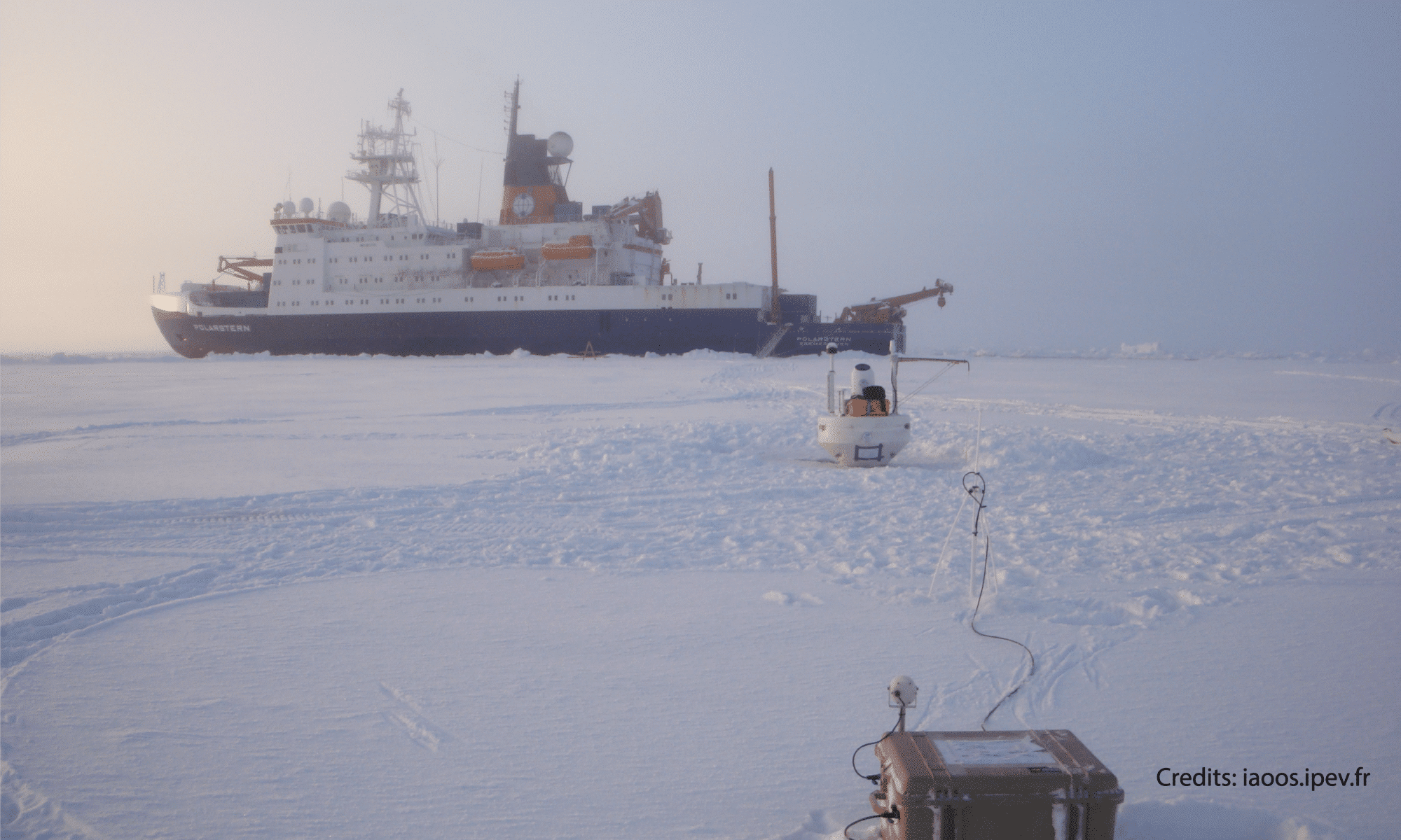
In September 2019, the German research icebreaker Polarstern set sail from Tromsø, Norway, to spend a year drifting through the Arctic Ocean, trapped in ice, to learn more about global warming and climate change.

This expedition is led by atmospheric scientist Markus Rex, and co-led by Klaus Dethloff and Matthew Shupe, MOSAiC is spearheaded by Alfred Wegener Institute, Hekmholtz Center for Polar and Marine Research (AWI).

The goal of the MOSAiC expedition is to require the closest look ever at the Arctic as the epicentre of worldwide warming and to realize fundamental insights that are key to raise understand global climate changes. The objective is to assess the impact of climate change on the region and on the world as a whole and, ultimately, to improve the performance of climate models in order to obtain more realistic projections.

In this expedition, TROPOS uses one of our Photometer (CE318-T) on the Polarstern to assist the scientists by measuring the atmosphere and providing data to help understanding the climatic model of the Arctic. (Follow the TROPOS campaign here).

MOSAiC expedition 2019
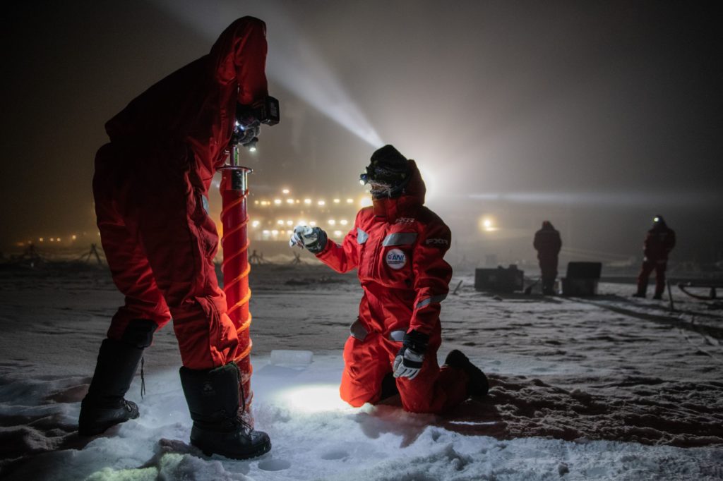
Scientific teams during MOSAiC campaign – December 15, 2019 (Alfred-Wegener-Institut / Esther Horvath)

The new and upcoming studies of the Poles are very important to understand our world, allowing new openings to new applications, new opportunities and new solutions for our environment.

All the results of the analysis will produce a flood of measurement data, which will be extremely valuable for the participating researchers and their peers around the globe, and also for humanity as a whole.

The MOSAiC expedition will end on October 12th after 390 days in extreme conditions for the 600 scientists who took turns in this incredible expedition in the Arctic.

Accordingly, the policy for MOSAiC data is based on a spirit of international cooperation, which all expedition participants expressly agree to adhere to. All the data is saved in the MOSAiC database wich is accessible by scientists of each country for detailed analyses and sharing it to the different members, states participating in this incredible and historical adventure.

If you want to follow the expedition, please check the MOSAiC website here or the Polastern Blog.

Image source: Alfred-Wegener-Institut / [Urheber/Fotograf] 

COVID-19

Research and atmosphere monitoring never stop, even during the COVID-19 pandemic

During the Covid-19 lockdown, the automatic CIMEL micro-pulse LiDARs continued profiling the atmosphere! The CIMEL micro-pulse LiDARs do not require supervised operation or human attendance, allowing recording continuous measurements during emergency situations like the Covid-19 lockdown.

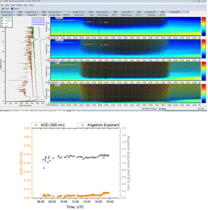
An example of continuous measurements performed by the CE376-GPN micro-pulse LiDAR (532 nm polarized and 808 nm unpolarized) along with the CE318-T Sun/Sky/Lunar photometer at Laboratoire d’Optique Atmosphérique (LOA) in Lille, France are presented below (Fig.1).

Figure 1: Measurements by the CE376-GPN micro-pulse LiDAR along with the CE318-T photometer at LOA in Lille

Since the lockdown in France on 16 March 2020, the CIMEL micro-pulse LiDAR continues measurements, providing long time series of LiDAR data which will allow to study the impact of the lockdown on air quality.

On the examples above, two situations are presented during this period: low fine particle loading from urban background pollution and a desert dust intrusion event on 27 March 2020 (Fig.1, left) and low aerosol loading (fine particles from urban background pollution) on 5 April 2020 (Fig.1, right).

The daily mean AOD at 500 nm recorded by the CE318-T sun photometer was 0.35 for the dust event on 27 March 2020 and 0.1 for the “clean” conditions on 5 April 2020.

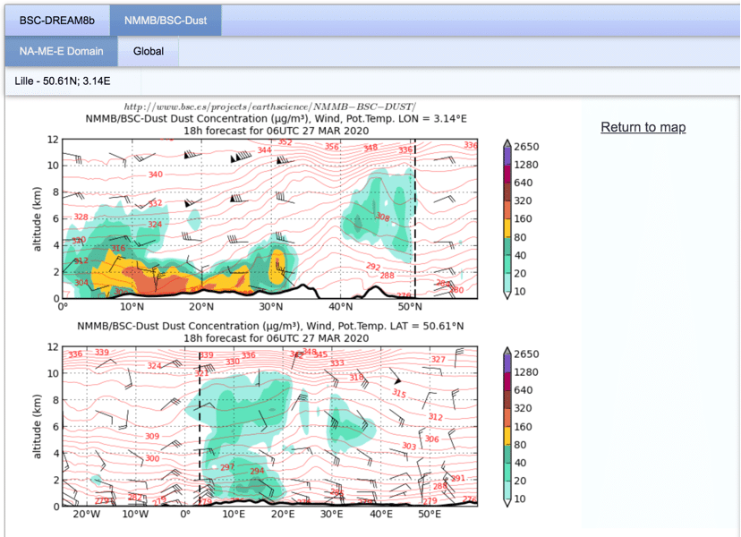
The desert dust intrusion event captured in CIMEL LiDAR data at Lille on 27 March 2020 is consistent with the Saharan dust intrusion forecasted by the NMMB/BSC-Dust model (See Fig.2 below), showing shallow dust layers in the 3 – 10 km altitude range (the dotted line on the dust forecast figure represents the location of Lille, France).

Figure 2: NMMB/BSC-Dust model

More recently, the CE376-GPNP micro-pulse LIDAR (Fig. 3) is operating at CIMEL in Paris, France, to provide more continuous data for the aerosols and clouds research community.

Figure 3: Measurements by the CE376-GPN micro-pulse LiDAR along with the CE318-T photometer at CIMEL in Paris

Earth Observation Satellites & Ground Monitoring  Solutions – an essential synergy for Air Quality and Climate Change

Earth Observation Satellites & Ground Monitoring  Solutions – an essential synergy for Air Quality and Climate Change

April 30, 2020

Atmospheric monitoring and climate analysis are strategic missions in order to improve the understanding of air quality dynamics and climate change evolutions. This in turn is a pre-requisite for providing reliable information reports with real data measurements and to help decision makers and end-users to understand the impacts and causes of air pollution with atmospheric impacts and to act upon it.

Satellite data is key for atmospheric and climate monitoring by providing a continuous and global view of the Earth parameters. These data are essential inputs for forecast models by improving their accuracy.

By combining satellite observations with models of the atmosphere and measurements from ground-based instruments, like Cimel Remote Sensing Solutions, it is possible to measure accurately and forecast aerosols (particles suspended in the air), as well as quantify gases level (ozonenitrogen dioxidesulphur dioxidecarbon monoxide…) and several other kind of environmental parameters (planetary boundary layer, water leaving reflectance for Ocean color, solar radiation, water vapor, atmospheric concentration profiles PM2.5/PM10…).

Cimel solutions keep working continuously and automatically, to help the calibration of satellite instruments and validate their data. Furthermore, Cimel is always active to support the various research activities from the worldwide scientific community.

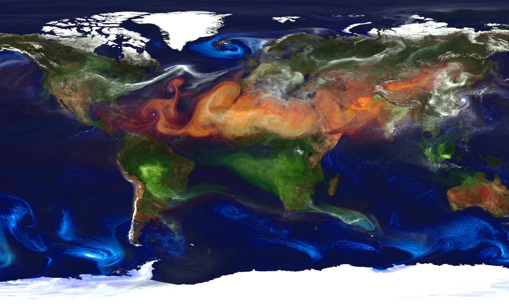
In this video, different aerosols are highlighted by color, including dust (orange), sea salt (blue), nitrates (pink) and carbonaceous (red), with brighter regions corresponding to higher aerosol amounts.

See more on: https://lnkd.in/edPSdrM

Credit: NASA Goddard Space Flight Center

Aerosol optical depth comparison between GAW-PFR and AERONET-Cimel radiometers from long-term (2005–2015) 1 min synchronous measurements

CE318-T Izaña

Aerosol optical depth comparison between GAW-PFR and AERONET-Cimel radiometers from long-term (2005–2015) 1 min synchronous measurements

August 9, 2019

A comprehensive comparison of more than 70 000 synchronous 1 min aerosol optical depth (AOD) data from three Global Atmosphere Watch precision-filter radiometers (GAW-PFR), traceable to the World AOD reference, and 15 Aerosol Robotic Network Cimel radiometers (AERONET-Cimel), calibrated individually with the Langley plot technique, was performed for four common or “near” wavelengths, 380, 440, 500 and 870 nm, in the period 2005–2015.

The goal of this study is to assess whether, despite the marked technical differences between both networks (AERONET, GAW-PFR) and the number of instruments used, their long-term AOD data are comparable and consistent.

The percentage of data meeting the World Meteorological Organization (WMO) traceability requirements (95 % of the AOD differences of an instrument compared to the WMO standards lie within specific limits) is >92 % at 380 nm, >95 % at 440 nm and 500 nm, and 98 % at 870 nm, with the results being quite similar for both AERONET version 2 (V2) and version 3 (V3). For the data outside these limits, the contribution of calibration and differences in the calculation of the optical depth contribution due to Rayleigh scattering and O3 and NO2 absorption have a negligible impact. For AOD >0.1, a small but non-negligible percentage (∼1.9 %) of the AOD data outside the WMO limits at 380 nm can be partly assigned to the impact of dust aerosol forward scattering on the AOD calculation due to the different field of view of the instruments. Due to this effect the GAW-PFR provides AOD values, which are ∼3 % lower at 380 nm and 2 % lower at 500 nm compared with AERONET-Cimel. The comparison of the Ångström exponent (AE) shows that under non-pristine conditions (AOD >0.03 and AE <1) the AE differences remain <0.1. This long-term comparison shows an excellent traceability of AERONET-Cimel AOD with the World AOD reference at 440, 500 and 870 nm channels and a fairly good agreement at 380 nm, although AOD should be improved in the UV range.

Citation: Cuevas, E., Romero-Campos, P. M., Kouremeti, N., Kazadzis, S., Räisänen, P., García, R. D., Barreto, A., Guirado-Fuentes, C., Ramos, R., Toledano, C., Almansa, F., and Gröbner, J.: Aerosol optical depth comparison between GAW-PFR and AERONET-Cimel radiometers from long-term (2005–2015) 1 min synchronous measurements, Atmos. Meas. Tech., 12, 4309–4337, https://doi.org/10.5194/amt-12-4309-2019, 2019.

READ THE ARTICLE

IAOOS

IAOOS – Ice Atmosphere Arctic Ocean Observing System

FEBRUARY 2011 – DECEMBER 2019

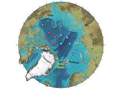
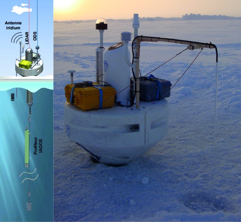
The IAOOS Project’s objective is to develop and maintain an automated observation network of ice-tethered platforms across the Arctic Ocean which will simultaneously and independently transmit via satellite, in near real time, the state of the ocean, sea ice and the lower atmosphere.

The project uses a CIMEL microlidar to monitor the atmosphere (T, conso, f optical window).

IAOOS project

The IAOOS equipment is based on 15 autonomous platforms working at any time in the Arctic Ocean, for a period of 7 years. Every platform, made up of 3 elements ocean / atmosphere / sea ice, drifts with the sea ice, the surface winds and the oceanic currents. They are designed to stay at the sea-ice surface and float on the surface of the ocean, with an autonomy of 2 years.

The IAOOS project plans the deployment of 6 platforms per year, following the plan of deployment of the first 15 platforms. Two periods of deployments are planned every year: in spring and in autumn.

Project
Observing, understanding and quantifying climate changes in the Arctic. IAOOS is specifically concerned with the potential for a significantly reduced sea ice cover, and the impacts this might have on the environment and on human activities, both regionally and globally.

Objectives

  • Deploy and maintain an integrated observing system providing simultaneous observations of the ocean, ice and lower atmosphere in real time in the Arctic
  • Complementary to satellite observations
  • Better understanding of interactions
  • Feed operational models
  • Improve predicting capabilities

Equipment on the IAOOS Platforms

  • CTD vertical profilers from 0 to 1000 m depth (conductivity, temperature, depth)
  • Ice Mass Balance (IMB)
  • Temperature and pressure sensors
  • CIMEL microlidars: T, conso, f optical window for atmosphere monitoring
  • Optical depth sensors (ODS)

Partners

IAOOS platform

References

  • Vincent Mariage, Jacques Pelon, Frédéric Blouzon, Stéphane Victori. IAOOS microlidar development and firsts results obtained during 2014 and 2015 arctic drifts . EPJ Web of Conferences, EDP Sciences, 2016, The 27th International Laser Radar Conference (IRLC 27), 119, 02005 (4 p.)(https://hal-insu.archives-ouvertes.fr/insu-01175931)
  • Vincent Mariage, Jacques Pelon, Frédéric Blouzon, Stéphane Victori, Nicolas Geyskens, Nadir Amarouche, Christine Drezen, Antoine Guillot, Michel Calzas, Magali Garracio, Nicolas Wegmuller, Nathalie Sennéchael, and Christine Provost, “IAOOS microlidar-on-buoy development and first atmospheric observations obtained during 2014 and 2015 arctic drifts,” Opt. Express 25, A73-A84 (2017) (https://doi.org/10.1364/OE.25.000A73)
  • Vincent Mariage. Développement et mise en oeuvre de LiDAR embarqués sur bouées dérivantes pour l’étude des propriétés des aérosols et des nuages en Arctique et des forçages radiatifs induits. Physique Atmosphérique et Océanique [physics.ao-ph]. Université Pierre et Marie Curie – Paris VI, 2015. Français. NNT : 2015PA066580

Sunbelt Spectra comparison with Standard ASTM G173: the Chilean case

Sunbelt Spectra comparison with Standard ASTM G173: the Chilean case

December, 2017

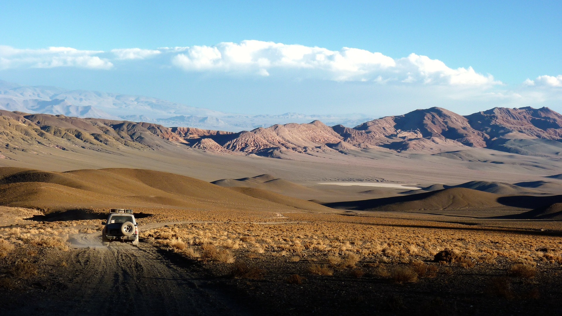
Two spectra of solar direct normal irradiance (including circumsolar) are estimated based on spatio-temporal averages of the relevant atmospheric parameters extracted from two different databases: MODIS satellite sensor retrievals and AERONET sun photometer network. The satellite database is used to calculate an average spectrum for the area of the Atacama Desert. The AERONET database is used for two purposes: (i) to apply bias-removal linear methods to correct the MODIS parameters over Atacama, and (ii) to calculate an average local spectrum for the Paranal station. The SMARTS radiative transfer model is used to obtain the three spectra developed in this study. Both the Atacama and Paranal spectra are compared against each other and also to the world reference, ASTM G173. In one of the cases, significant differences are found for short wavelengths. In order to quantify the relative importance of these spectral differences, the propagation of errors due to the use of each spectrum is evaluated for CSP applications over the Atacama Desert, considering twelve different scenarios involving the reflectance, transmittance or absorptance of various materials.

Citation: Marzo, Aitor & Polo, Jesus & Wilbert, Stefan & Gueymard, Chris & Jessen, Wilko & Ferrada, Pablo & Alonso-Montesinos, Joaquín & Ballestrín, Jesús. (2017). Sunbelt Spectra comparison with Standard ASTM G173: the Chilean case. AIP Conference Proceedings. 2033. 10.1063/1.5067195.

READ THE ARTICLE

Image source: Pixabay

FIREX – AQ Mission

FIREX – AQ Mission

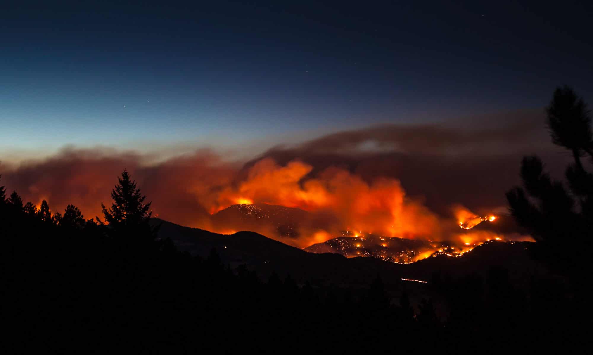
Approximately half of fire emissions in the US are from Northwestern wildfires and half are from prescribed fires that burn mostly in the Southeast US. Wildfires burn slightly more fuel and therefore have overall larger emissions, but prescribed fires dominate the area burned and the number of fires. FIREX-AQ will investigate both wild and prescribed fires. Wildfires generally result in exposures with larger pollution concentrations over larger areas, and cause both local and regional air quality impacts. Their emissions are often transported thousands of miles and can impact large regions of the US at a time. Prescribed fires are usually smaller and less intense than most wildfires but occur more frequently and throughout the whole year. They are usually ignited during periods that minimize population expose and air quality impacts, but can cause regional backgrounds to increase, are generally in closer proximity to populations, and are responsible for a large fraction of the US PM2.5 emissions.

This summer, NOAA and NASA are teaming up on a massive research campaign called FIREX-AQ that will use satellites, aircraft, drones, mobile and ground stations to study smoke from wildfires and agricultural crop fires across the U.S. 

Objective: To improve understanding of wildfire and agricultural fire impacts on air quality, weather, and climate.

Cimel provides a CE376 micro-LiDAR as well as its network of CE318-T photometers through AERONET. These solutions will provide detailed measurements of aerosols emitted from wildfires and agricultural fires to address science topics and evaluate impacts on local and regional air quality, and how satellite data can be used to estimate emissions more accurately.

The Primary Mission Partners are:

Photo: P. Cullis, NOAA / CIRES